Digital Cartography
- Production and updating of topographic maps by various standards and coordinate systems JTM, (UTM) for Jordan and others.
- Production and updating of tourist maps.
- Production and updating of provincial maps in Arabic/English.
- Production and modernization of geological maps by various measures.
- Production and updating of mural maps.
- Production of transportation maps in Arabic/English
- Production and modernization of school atlases in Arabic and English.
- Production of various advertising maps.
- Scan work.
Aerial Survey
- Track image features and categorize them according to their uses. Example: roads, buildings, valleys, and agricultural areas.
- Draw level lines.
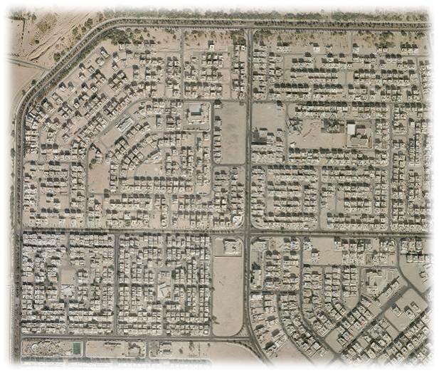
- Edit orthophoto aerial images.
- Production of the DTM ground representation model.
Department of Astronomy and Timings
- Participation in the family committees and determining the beginning of each Hijri month (The Crescent Committee / The General Iftaa Department / The Islamic Project Committee to Monitor The Crescent).
- Participation in a committee that sets prayer times for all governorates of the Kingdom in cooperation with the Ministry of Endowments, Islamic Affairs and Holy Places
- Follow up, monitor and document astronomical phenomena.
Field Survey Department :
- Maintaining and maintaining networks (geodesic, fine leveling, GPS) and providing their official and private entities.
- Carrying out all field survey work for various projects related to the geographical center.
- Implementation of field projects for public and private institutions and individuals that come through the Planning Directorate such as the establishment of new survey points or rule points or the identification of the kiss of mosques or the identification of the north ... Etc.
- Supervising all field teams working in the field and following up all their work.
- Provide the official and private entities with the geodesic network points and settlement network points they need in their field work.
- Keep a copy of the results of all field work in the field survey archives for reference in time of need.
- Provide the training department and the Faculty of geographical center with trainers to teach some surveyors and training in the conduct of various field surveyors.
- Develop the technical specifications of the devices used in the department, and participate with ministries and other institutions to develop technical specifications for surveyors.
- Transforming the coordinates of the spatial points between the various coordinate systems.
Space reconnaissance Department :
Establishment of the space reconnaissance department
1. The Space Reconnaissance Department was newly established to meet the additional needs of the production process at the Royal Jordanian Geographical Center.
2. Staff of the Space Reconnaissance Department with different experiences and high skills.
3. The space reconnaissance section follows:-
A- Division of Navigation and Aerial Photography.
b- Aerial photography laboratory.
Duties and tasks of the space reconnaissance department
1. Providing the Jordanian armed forces and public and private institutions with the necessary needs of aerial and satellite images and maps, and providing the geographical center sections with aerial photographs.
2. Correcting aerial and satellite images and producing orthophoto paintings.
3. Create and update digital databases of satellite images and various maps.
Division of Navigation and Aerial Photography
Air Navigation Division Content:
1. Airplane
2. Leica Rc 30 . aerial camera
3. Track air
4. Aerial camera crew.
5. Aerial photography lab